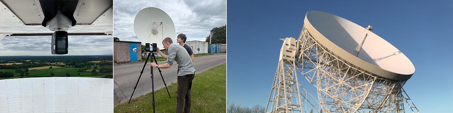


Manchester Metrology provided a FARO Focus S350 3D terrestrial laser scanner on hire for a four-week project to map telescope reflector surfaces at Jodrell Bank Observatory.
Using the scanner hired from us, summer interns William Vyner-Brooks and Conrad Szyman at Jodrell Bank Observatory created high-resolution 3D maps of the Lovell, Mark II and 7-metre telescope reflector surfaces. Their analysis produced colour-coded deviation maps and a model of how the Lovell Telescope bowl distorts at different elevations.
The challenge
A radio telescope reflector must follow its intended parabolic geometry as closely as possible. On a large, fully steerable structure such as the Lovell Telescope, the shape changes as the telescope moves and gravitational loading varies with elevation. When these changes are known, they can be compensated for by electronic or mechanical means at the receivers, conceptually similar to the Hubble Space Telescope.
The internship project set out to map the Lovell Telescope and other antennas at Jodrell Bank Observatory, quantify departures from their ideal reflector shapes and establish how the Lovell bowl deforms at different elevations. The resulting information is helping the evaluation of possible corrective measures, particularly for high-frequency X-band operation.
Our role
We provided the FARO Focus S350 on hire for the telescope measurement project, along with introductory training in using the equipment and FARO SCENE software.
William Vyner-Brooks and Conrad Szyman carried out the scanning and analysis during their four-week internship at Jodrell Bank Observatory.
Why the FARO Focus S350 was used
The FARO Focus S350 is a compact, long-range terrestrial laser scanner designed to turn physical environments into dense, measurable three-dimensional point clouds. For this project, a portable instrument could be positioned around complex telescope structures, as well as on the structure itself, to capture reflector geometry that would be difficult to measure using conventional methods.
The scanner combines a Class 1 laser with a dual-axis compensator, integrated height sensing, electronic compass and GNSS. Its coaxial colour system minimises parallax between geometry and imagery, while HDR exposure bracketing helps record colour detail where brightness varies strongly. A touchscreen and WLAN connection support control in the field.
For the Jodrell Bank work, the instrument’s combination of portability, reach, wide field of view, colour capture and measurement density was especially valuable. Some of the Lovell Telescope scans contained up to 400 million points, providing a detailed geometric record from which subtle surface departures could be investigated.
A four-week metrology mission
William Vyner-Brooks and Conrad Szyman joined Jodrell Bank Observatory for a four-week summer internship. They started by capturing high-resolution scans of the 21-ft Student Telescope to learn how the FARO Focus S350 operated before moving on to the 80-ft Mark II Telescope.
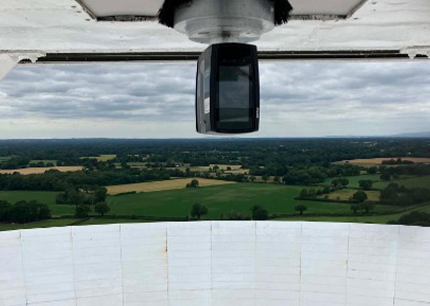
Once the other telescopes had been successfully mapped and the workflow refined, the enormous 250-ft Lovell Telescope surface was scanned. Scans were taken from the telescope’s focus box, with the telescope pointing straight up, and from the ground, with the dish pointing at various elevations.
Each scan took roughly an hour to complete, gathering hundreds of millions of points. The scanner provided sub-millimetre point-cloud data and accurate colour information, which could be exported and processed using software, some of it written by William and Conrad.
From point clouds to deformation maps
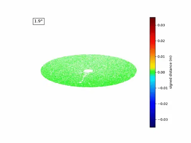
Each point cloud was compared with the relevant ideal geometry of the dish surface. Colour-coded heatmaps quantified where the measured surface departed from the ideal, allowing both the overall dish and individual panels to be assessed.
For the Lovell Telescope, scans obtained at different elevations were combined to model deformation as a function of telescope position.
Linking measurement with simulation
After processing and simplification, the point clouds were converted into surface meshes suitable for import into Dassault Systèmes CST Studio. These measured geometries can support electromagnetic simulations, helping to evaluate how reflector deformation affects telescope quality and to simulate the effectiveness of corrective measures.
The workflow followed five stages:
1. Scan: Capture reflector geometry.
2. Compare: Measure deviation from the ideal surface.
3. Model: Track deformation at different elevations.
4. Simulate: Assess the effects on radio-frequency performance.
5. Correct: Evaluate possible improvements.
The outcome
Within only four weeks, the interns progressed from field capture to detailed surface analysis and elevation-dependent modelling.
Their work produced datasets that can contribute to the continuing engineering assessment of the Lovell Telescope and demonstrated how modern metrology can support the study of exceptionally large scientific instruments.
=================
Need to hire a 3D laser scanner for your project?
We offer FARO Focus S350 laser scanner hire. Call us on 0161 637 8744 to discuss your requirements.